
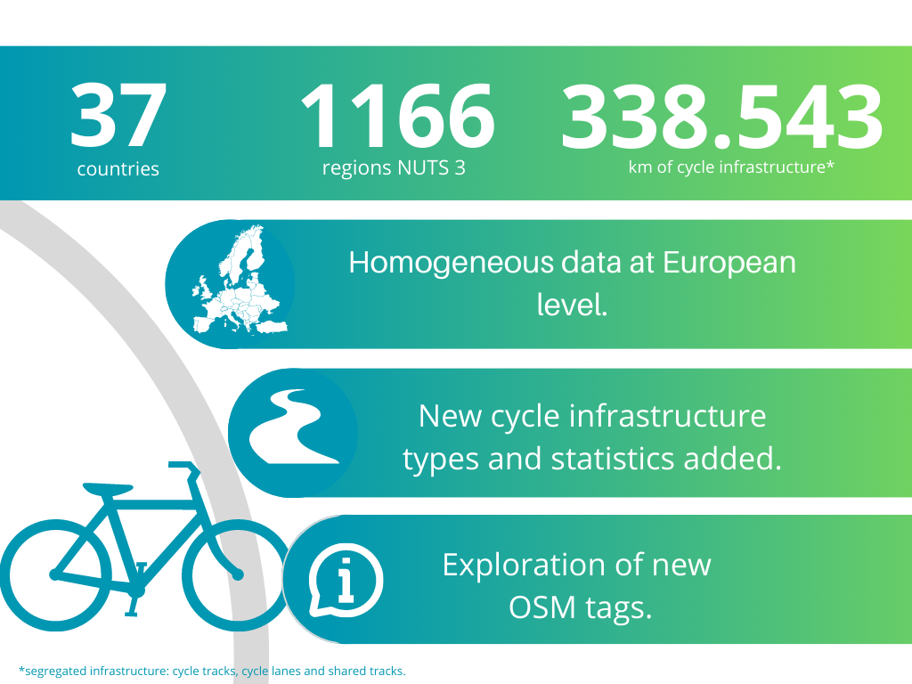
Quantifying Europe’s Cycling Infrastructure using OpenStreetMap (QECIO 2.0)
There is great demand for data on cycling infrastructure, but currently, no official source provides this kind of information on a European scale. This data project responds to this need by extracting data about cycling infrastructure from OpenStreetMap (OSM). We generalised the methodology to cover most of Europe, took into account additional infrastructure types and provided additional statistics.
This project is the second edition of Quantifying Europe’s Cycling Infrastructure using Open Street Map (QECIO 2.0.). To access the results from the previous edition click here.
Overview
Results
Attention! We have moved our results to our ECF website
Metadata
Please click the following link to be redirected to the Metadata page. The page contains files for further analysis.
Downloads
Please visit our download page. Downloads
The Methodology
The methodology can be accessed through this link
Built With
Authors
- Andrea Chavez-Pacheco- a.chavez@ecf.com
- Aleksander Buczyński - a.buczynski@ecf.com
- Eleanor Denneman
with technical assistance from Agilitic as part of 1% for the Planet program.